
Most travelers experience the legendary Ma Pi Leng Pass from the seat of a motorbike. But to truly see the “King of Passes,” you have to go higher.
The Sky Path (also known as the Ma Pi Leng Skywalk) is a high-altitude trail that sits far above the main highway. It leads you to the White Cliff, a massive rock wall where you can look straight down into the deepest canyon in Southeast Asia.
If you want to escape the traffic and find some peace, this is the best short hike on the Ha Giang loop.
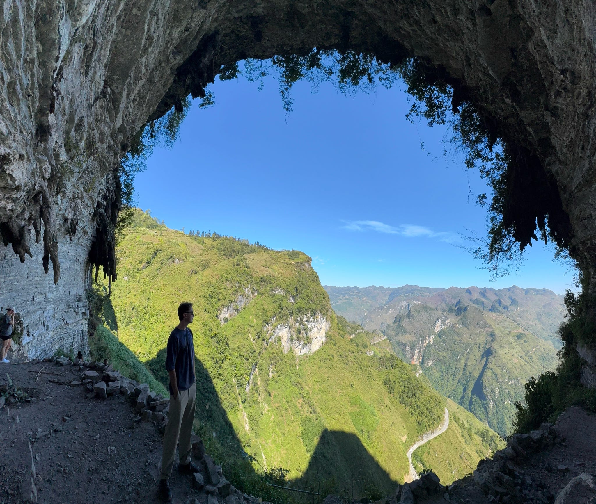
The view from White cliff – Ha Giang from above
Table of contents
Quick Facts: The Sky Path Hike
- Time Needed: 2.5 to 3 hours.
- Walking Distance: About 7km total.
- Difficulty: Easy to Moderate. The path is clear, but it is little high up!
- Best View: The Nho Que River and the Ma Pi Leng Pass from 1,700m high.
How to Find the Trail
The hike starts at the Happiness Road Museum at the top of Ma Pi Leng Pass.
- Start: Look for the small concrete path going up the hill across from the museum.
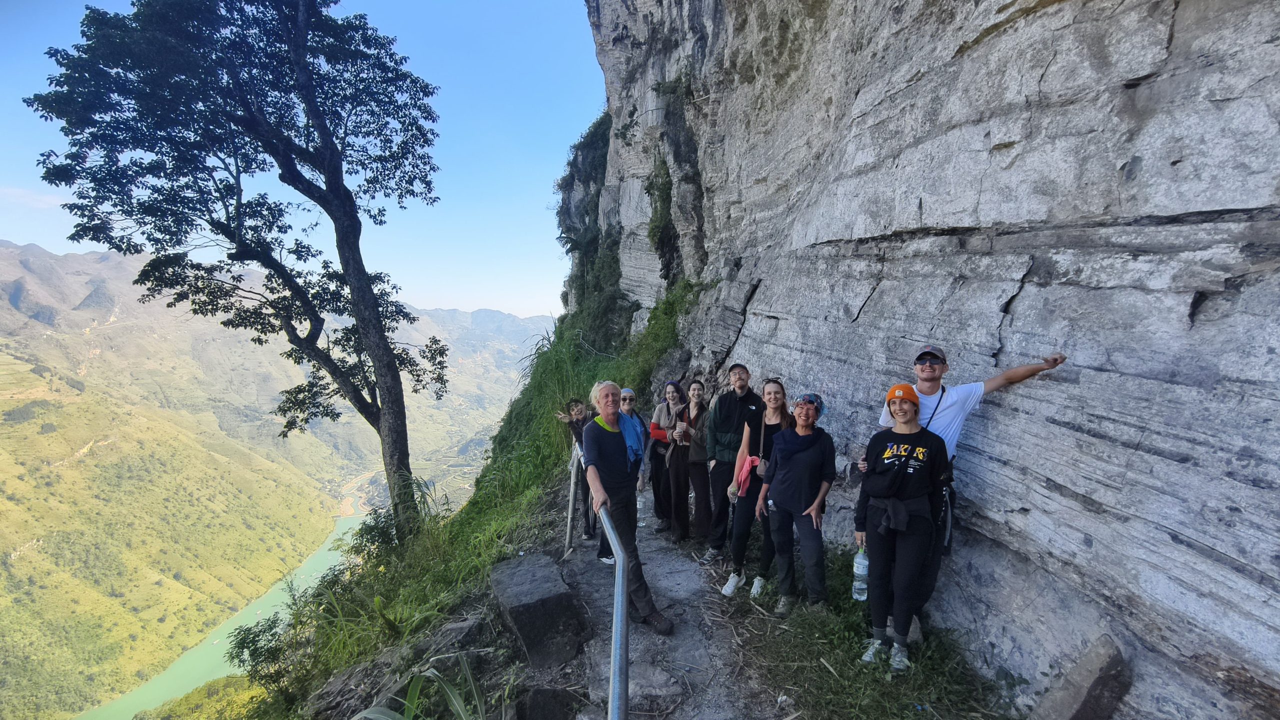
- The Path: You’ll walk past local Hmong homes and small corn fields.
- The Goal: Follow the cliffside path until you reach the White Cliff (Vách Đá Trắng). This is the ultimate photo spot.
Looking for a guide who knows best about the trails?
We include this walk on Day 2 of our itinerary:
Why You Should Do This Hike
1. Escape the Motorbike Crowds
While thousands of people stay on the busy “Happiness Road” below, the Sky Path belongs to the hikers and the locals. It is one of the few places on the Ha Giang Loop where you can trade the sound of engines for the quiet of the mountains and the friendly “Hello!” of the Hmong people.
2. A Glimpse into Real Local Life
Beyond the mountain views, the Sky Path is a living trail. As you walk, you will pass through small Hmong hamlets where life continues just as it has for generations. You’ll see local families working their hillside corn fields, meet smiling kids playing outside their houses, and likely be greeted by the family dogs and buffaloes that call these high ridges home.
3. The Best View of the Nho Que River
At 1,700m on the White Cliff, the emerald Nho Que River looks like a vibrant silk thread winding through the deep Tu San Canyon. From this bird’s-eye view, you can truly see the massive scale of the canyon and the tiny tour boats drifting 1,000 meters below.
1,700 Meters High: The Emerald Nho Que River from the White Cliff.
What to Wear & Bring
You don’t need professional gear, but you should be prepared. Check our Ha Giang Loop Packing List for more details, but here are the basics:
- Wear Layers: Start with a T-shirt as your base layer; you’ll likely warm up while walking and hiking the inclines.
- Bring a Jacket: Even if it feels hot on the road, it could get much windier up on the cliff. A lightweight windbreaker or fleece is perfect for when you stop to take photos.
- Proper Shoes: Wear sneakers or hiking shoes with good grip, flip-flops are not safe for this terrain.
- Water & Snacks: There are no shops on the cliffside. Bring at least 0.5L of water to stay hydrated during the 3-hour trek.
From the High Cliffs to the Nho Que River Campsite
After conquering the high-altitude trails, we descend from the limestone peaks to the canyon floor for an unforgettable wild camping experience on the Nho Que River.
Trading the windy cliffs for the lush riverbank, you’ll spend the night under the stars at our private campsite right by the emerald water. It’s the perfect way to transition from a day of hiking to a morning of kayaking through the heart of the Tu San Canyon.
Book Your Adventurous Ha Giang Loop Tour: camping, kayaking, hiking.
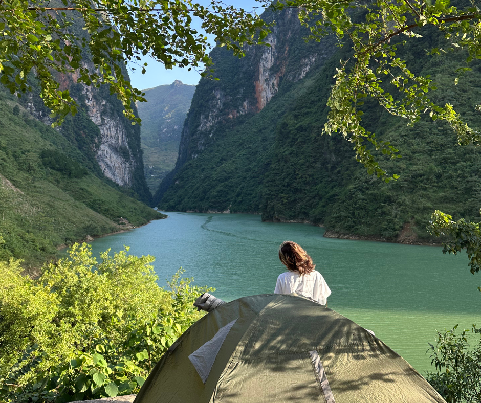
From Peak to Pier: Our Private Riverside Camp at Nho Que.