The Ha Giang Mountains offer some of the most spectacular scenery in northern Vietnam, where towering limestone peaks rise above deep valleys and winding roads carve their way through rugged terrain. Shaped by millions of years of geological change, these mountains have created a remarkable natural environment that also influences the lives and traditions of local ethnic communities. As a result, Ha Giang attracts visitors not only for its breathtaking landscapes but also for its fascinating geology, biodiversity and rich cultural heritage. Join Ha Giang Expeditions to explore the remarkable beauty of these mountains and discover what makes this region one of northern Vietnam’s most captivating destinations.
Table of contents
- Where Are the Ha Giang Mountains Located?
- Geography and Geological Features of the Ha Giang Mountains
- Flora and Fauna in the Ha Giang Mountains
- Ethnic Communities and Life in the Mountains
- Famous Natural Landmarks in the Ha Giang Mountains
- Hiking and Mountain Routes in Ha Giang
- Exploring the Mountains Along the Ha Giang Loop
- Plan Your Ha Giang Mountain Adventure with Ha Giang Expeditions
Where Are the Ha Giang Mountains Located?
The Ha Giang Mountains are located in Vietnam’s far north, near the Chinese border, approximately 300 kilometers from Hanoi. Historically part of Ha Giang Province, the region became part of the newly expanded Tuyen Quang Province following Vietnam’s administrative reorganization in 2025. However, Ha Giang remains the familiar geographical and tourism name used to describe this northern highland destination.
The region includes several distinct mountainous areas, with the Dong Van Karst Plateau occupying much of the northeastern highlands. Recognized as a UNESCO Global Geopark, the plateau extends across the former districts of Quan Ba, Yen Minh, Dong Van and Meo Vac. Farther west, the mountainous areas around Tay Con Linh and Hoang Su Phi have different environmental conditions and landscapes, reflecting the geographical diversity of the wider Ha Giang region.
Geography and Geological Features of the Ha Giang Mountains
The geography of the Ha Giang Mountains varies considerably across the region, with different geological structures creating distinct landforms. Among these, the limestone formations of Dong Van Karst Plateau and the network of valleys, mountain passes and river canyons offer a closer look at the region’s diverse terrain.
The Limestone Mountains of Dong Van Karst Plateau
The Dong Van Karst Plateau is one of the most distinctive geological landscapes in the Ha Giang Mountains, stretching across the highland areas of Quan Ba, Yen Minh, Dong Van and Meo Vac. Unlike the forest-covered mountains found in many other parts of northern Vietnam, much of the plateau is dominated by exposed limestone, steep rocky slopes and narrow valleys. Its complex terrain reflects a long geological history, with several remarkable features:
- Ancient geological formations: The plateau contains sedimentary rocks dating back hundreds of millions of years, preserving fossils and geological evidence of ancient marine environments.
- Dramatic limestone landscapes: Sharp mountain ridges, jagged peaks and extensive rocky outcrops create the rugged scenery that defines much of the plateau.
- Unique karst formations: The gradual dissolution of limestone by water has contributed to the development of caves, enclosed depressions and natural rock gardens, including those found in Khau Vai and Van Chai.
- Rocky agricultural landscapes: With limited fertile soil available, local ethnic communities have adapted their farming methods to cultivate crops in small patches of land between limestone rocks.
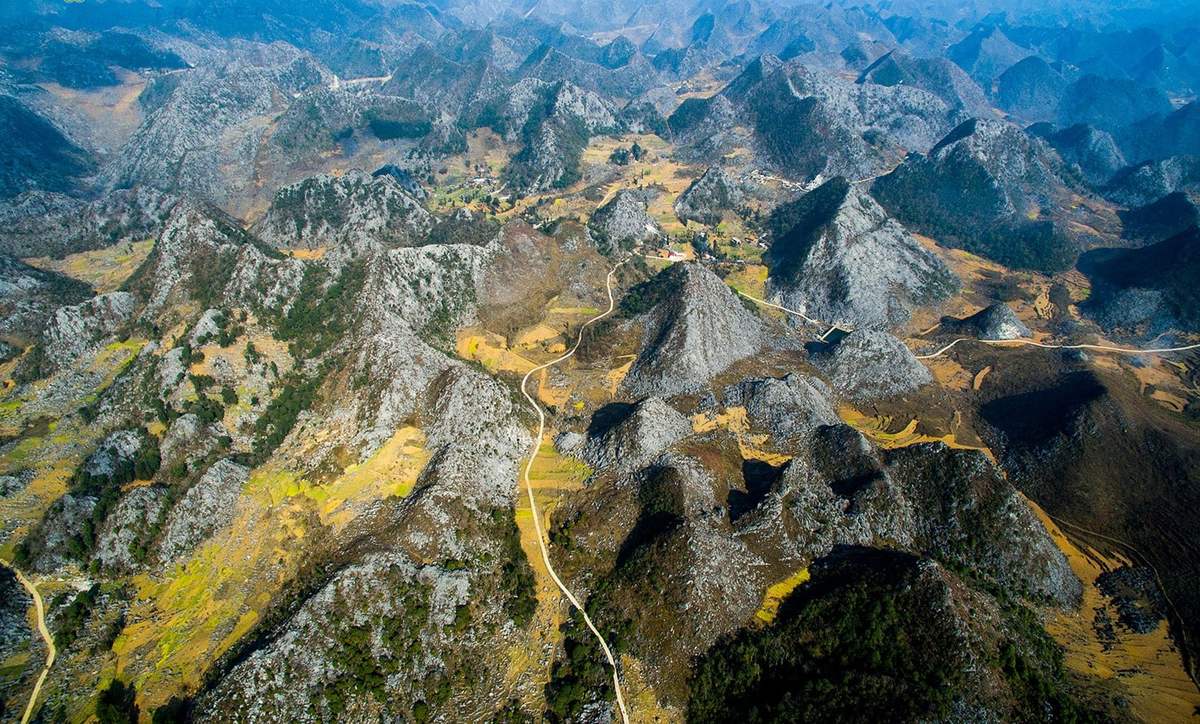
Together, these features make the Dong Van Karst Plateau an exceptional example of how geological processes have shaped both the natural landscape and human settlement in northern Vietnam.
Deep Valleys, Mountain Passes and River Canyons
Beyond its limestone peaks, Ha Giang’s mountainous terrain is deeply divided by river valleys and steep gorges. Geological movements, combined with the erosive action of flowing water, have gradually shaped these dramatic landforms. As a result, the landscape features significant elevation differences over relatively short distances, creating narrow valleys beneath towering mountain slopes and winding roads that follow the contours of the terrain.
The region’s river systems also influence the distribution of settlements and transportation routes. In areas where the terrain is too steep for direct road construction, mountain roads follow the natural contours of the terrain and cross ridges through mountain passes. Meanwhile, villages and agricultural land are often concentrated in valleys or on slopes where soil and water are more accessible. These geographical conditions explain why traveling relatively short distances through Ha Giang can involve considerable changes in elevation and road conditions.
Flora and Fauna in the Ha Giang Mountains
The Ha Giang Mountains support a diverse range of plant and animal life, influenced by differences in elevation, climate and terrain. While the rocky highlands of Dong Van are known for their sparse vegetation, other mountainous areas contain forests that provide important habitats for wildlife. These contrasting environments contribute to the region’s ecological diversity, with vegetation and natural scenery changing noticeably across different locations and seasons.
Mountain Vegetation and Seasonal Landscapes
Vegetation in the Ha Giang Mountains varies according to altitude, soil conditions and water availability. On the Dong Van Karst Plateau, where limestone covers much of the surface, plants often grow in narrow rock crevices or small pockets of soil. In contrast, areas with deeper soil and more favorable moisture conditions support denser vegetation, including broadleaf forests, bamboo and shrubs.
The changing seasons also bring noticeable differences to the mountain landscape:
- Spring (February – April) brings flowering peach and plum trees to many highland villages, while warmer temperatures encourage new plant growth.
- Summer (May – August) is generally warm and rainy, allowing vegetation and cultivated fields to become greener. However, heavy rainfall can also make mountain roads slippery and increase the risk of landslides.
- Autumn (September – November) is associated with ripening rice fields in agricultural areas and buckwheat flowers on parts of the Dong Van Karst Plateau, particularly during October and November.
- Winter (December – January) brings colder temperatures, especially at higher elevations. Mist and low clouds frequently settle over mountain valleys, while deciduous plants and agricultural fields may appear less green than during the rainy season.
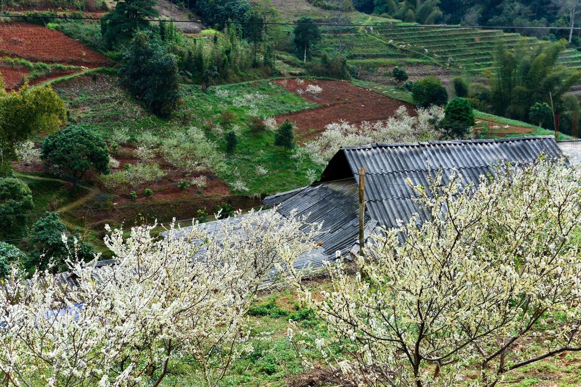
These seasonal changes create different conditions for plant growth and give the Ha Giang Mountains a distinct appearance throughout the year.
Wildlife and Biodiversity
The forests of Ha Giang provide habitats for a wide variety of wildlife, including mammals, birds, reptiles and amphibians. Some of the region’s most important habitats are found in protected forest areas such as Tay Con Linh, Du Gia and Khau Ca, where conservation efforts help preserve native species and their natural environments.
- Tay Con Linh Nature Reserve is known for its subtropical evergreen forests. Conservation records have documented 796 plant species and 213 animal species, including numerous rare and threatened species.
- Du Gia Nature Reserve contains tropical evergreen forests and limestone forest habitats that support a variety of mammals. Its ecological importance has been highlighted in scientific research on wildlife diversity in the Du Gia – Khau Ca region.
- Khau Ca Conservation Area provides critical habitat for the Tonkin snub-nosed monkey (Rhinopithecus avunculus), one of Vietnam’s rarest primates. This critically endangered species is found only in northern Vietnam, making the protection of its remaining forest habitat particularly important.
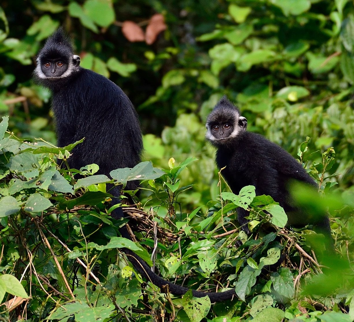
Despite this biodiversity, wildlife in Ha Giang faces ongoing pressures from habitat degradation, hunting and human activities. Protecting natural forests and involving local communities in conservation are therefore essential for maintaining the region’s ecological balance. These efforts also help preserve the mountain ecosystems that make Ha Giang such an important area for biodiversity in northern Vietnam.
Ethnic Communities and Life in the Mountains
The Ha Giang Mountains have been home to ethnic communities for generations, with the Hmong, Tay, Dao, Nung and Lo Lo among the groups that have shaped the region’s cultural identity. Each community has developed its own language, customs, traditional clothing and ways of life. Over time, these traditions have evolved alongside the challenges of living in a remote mountainous environment, where access to farmland, water and transportation has long influenced daily activities.
Daily life in Ha Giang also reflects the practical knowledge that local communities have developed over generations. Farming calendars follow seasonal rainfall and temperature changes, while traditional building materials vary according to local resources and cultural practices. In several Hmong villages, earthen houses and stone fences remain familiar features of the residential landscape. Elsewhere, Tay communities are known for traditional stilt houses, particularly in valleys where access to water and agricultural land has supported long-established settlements. These differences illustrate how cultural traditions and local environmental conditions have influenced the development of highland villages.
Beyond farming, the cultural heritage of Ha Giang is preserved through a variety of traditions:
- Hmong communities are known for their traditional khèn music, the Gau Tao festival and distinctive earthen houses.
- Dao communities maintain elaborate embroidery traditions and ceremonies such as the Cap Sac coming-of-age ritual.
- Tay communities preserve agricultural festivals such as Long Tong, which is associated with hopes for a successful farming season.
- Lo Lo communities, particularly around Lung Cu, are recognized for their colorful embroidered clothing and traditional ceremonial practices.
Today, traditional village life continues alongside the development of community-based tourism. Places such as Lo Lo Chai near Lung Cu and Nam Dam in Quan Ba offer opportunities to learn about local architecture, handicrafts and everyday customs through village visits and homestays. These activities have also created additional sources of income for some households, helping communities maintain their cultural heritage while adapting to changing economic conditions.
Famous Natural Landmarks in the Ha Giang Mountains
Some of the most memorable experiences in the Ha Giang Mountains come from seeing how dramatically the surroundings change across the region. Elevated viewpoints reveal the scale of the highlands, while places closer to the valleys offer a different perspective on the terrain. Historic settlements add another dimension to the journey, showing how communities have developed around these natural formations. The following landmarks highlight the distinctive character of Ha Giang’s mountain environment.
Ma Pi Leng Pass Ha Giang – The Dramatic Mountain Ridge
Located on National Highway 4C between Dong Van and Meo Vac, Ma Pi Leng Pass Ha Giang is one of Vietnam’s most impressive mountain roads. Rising to approximately 1,500 meters above sea level, the pass follows steep limestone cliffs and forms part of the historic Happiness Road, which was constructed between 1959 and 1965 to connect remote highland communities.
Today, visitors can explore the pass through:
- Roadside viewpoints provide wide views across the mountain ridges and the deep Nho Que River valley. The scenery changes with the road’s elevation and direction, making several short stops worthwhile.
- Ma Pi Leng Skywalk follows an older mountain path above the valley, offering a more exposed perspective on the surrounding cliffs. Some sections are narrow and uneven, so visitors should assess the conditions before attempting the walk.
- Weather and visibility can significantly affect the experience. Low clouds may obscure distant peaks, while rain can make the road surface slippery and reduce visibility around sharp bends.
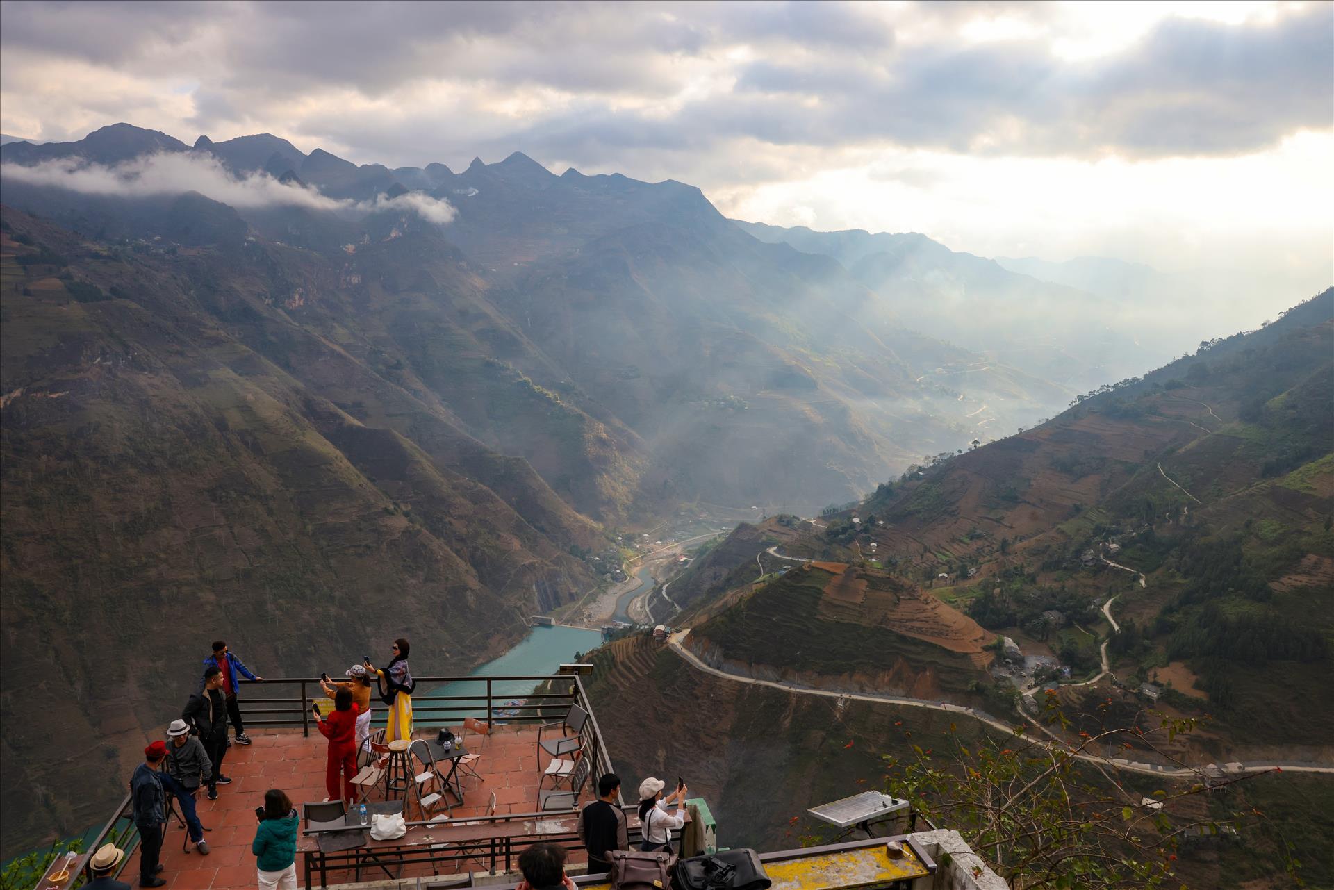
For travelers who would rather enjoy these views without navigating the demanding road themselves, the Classic Ha Giang Loop 4D3N includes Ma Pi Leng Pass as part of a longer highland journey. The itinerary allows time for scenic stops and visits to surrounding communities, with motorbike, car and Jeep travel options available.
Nho Que River Ha Giang – A River Carving Through Limestone Mountains
While Ma Pi Leng reveals the mountains from above, Nho Que River Ha Giang offers a completely different perspective from deep within the valley. Originating in China’s Yunnan Province, the river flows into northern Vietnam and passes through the limestone terrain near Dong Van and Meo Vac. Its most striking section runs through Tu San Canyon, where towering rock walls rise approximately 700 – 800 meters above the water in places.
The river is widely recognized for its emerald-green appearance, although its color can vary depending on rainfall and water conditions. Surrounded by steep cliffs, the narrow waterway creates an atmosphere quite different from the exposed mountain roads above.
Boat trips through Tu San Canyon are among the most popular activities in the area, offering close-up views of the limestone formations. Kayaking is another option when river conditions permit, providing a more active way to explore the canyon. The experience is particularly memorable because the scale of the surrounding cliffs becomes much more apparent when viewed from the water.
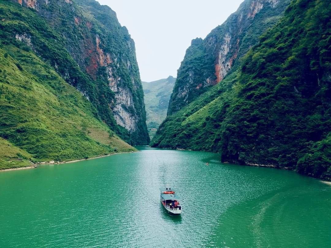
Our Adventure Ha Giang Loop 3D2N combines kayaking on the Nho Que River with a night of camping at Tu San Canyon and hiking above the valley. Rather than viewing the landscape only from the mountain road, the itinerary provides opportunities to experience the canyon at different elevations and spend more time in its natural surroundings.
Heaven’s Gate Ha Giang – A Panoramic View of Quan Ba Valley
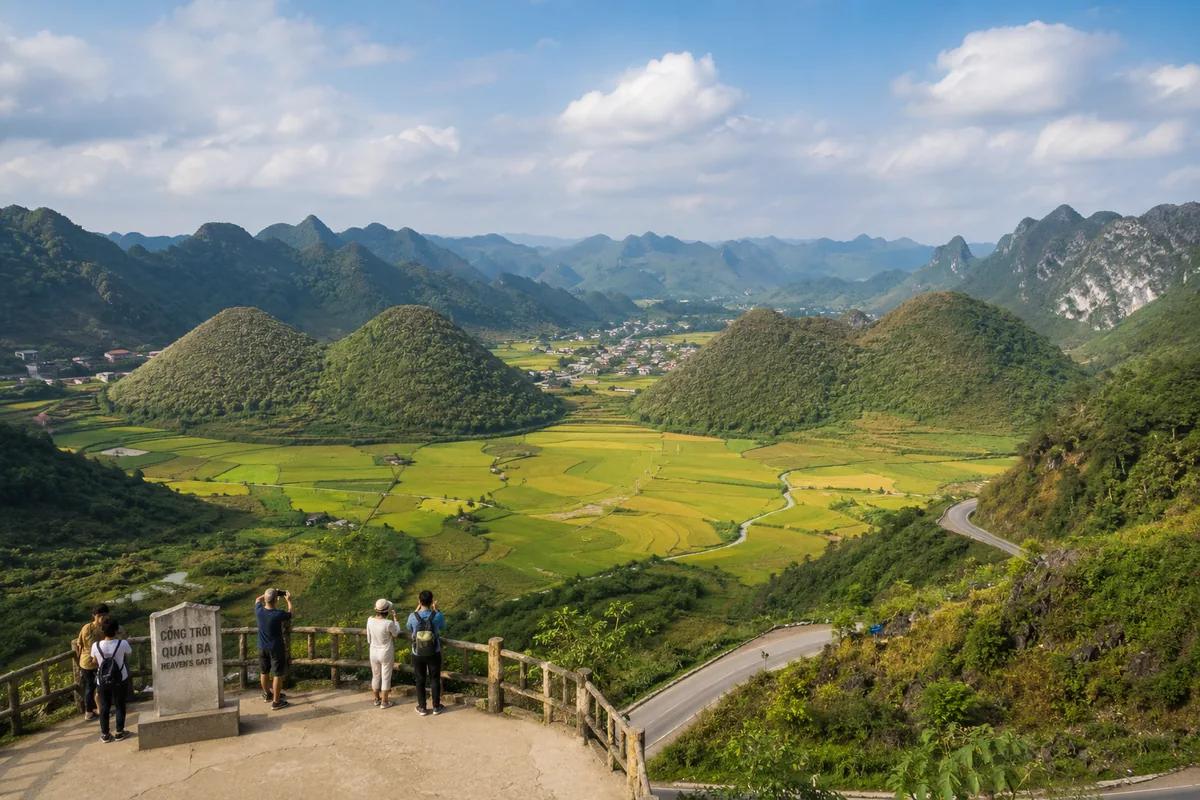
The scenery changes noticeably around Quan Ba, where Heaven’s Gate Ha Giang overlooks the broad Tam Son Valley. Situated along the mountain road north of Ha Giang City, this viewpoint stands at approximately 1,500 meters above sea level and offers a sweeping panorama of cultivated fields, scattered settlements and surrounding hills.
Among the most recognizable landmarks visible from the viewpoint are the Quan Ba Twin Mountains, also known as the Fairy Bosom Mountains. Their distinctive rounded shapes contrast with the sharper limestone formations found elsewhere in the highlands. According to local folklore, the hills are associated with a love story between a fairy and a Hmong man, adding cultural significance to the natural landscape.
Heaven’s Gate is often one of the first scenic stops on a Ha Giang Loop journey. During our tours, the ascent toward Quan Ba provides an opportunity to appreciate how the landscape gradually changes as the route approaches the Dong Van Karst Plateau. Clear mornings generally offer better visibility across the valley, although mountain weather can change quickly.
Dong Van Ha Giang – A Historic Town in the Rocky Highlands
After traveling through the rugged highlands, Dong Van Ha Giang introduces another side of the region through its historic streets and traditional mountain culture. Surrounded by limestone peaks, the town has long served as a gathering place for communities living across the Dong Van Karst Plateau.
Its most distinctive attraction is Dong Van Old Quarter, where traditional houses with earthen walls, timber structures and tiled roofs reflect the area’s architectural heritage. Walking through the narrow streets, visitors can find small cafés, local restaurants and family-run shops operating alongside older residential buildings.
Beyond the old quarter, visitors can explore:
- Dong Van Sunday Market brings together residents from surrounding villages to trade local produce, traditional clothing and everyday goods. The weekly gathering also provides an important opportunity for social interaction.
- Vuong Family Palace, located in Sa Phin, preserves the history of the influential Vuong family and features architectural elements associated with Hmong, Chinese and French traditions.
- Lung Cu Flag Tower, situated near Vietnam’s northern border, is a symbolic landmark overlooking the surrounding mountainous countryside.
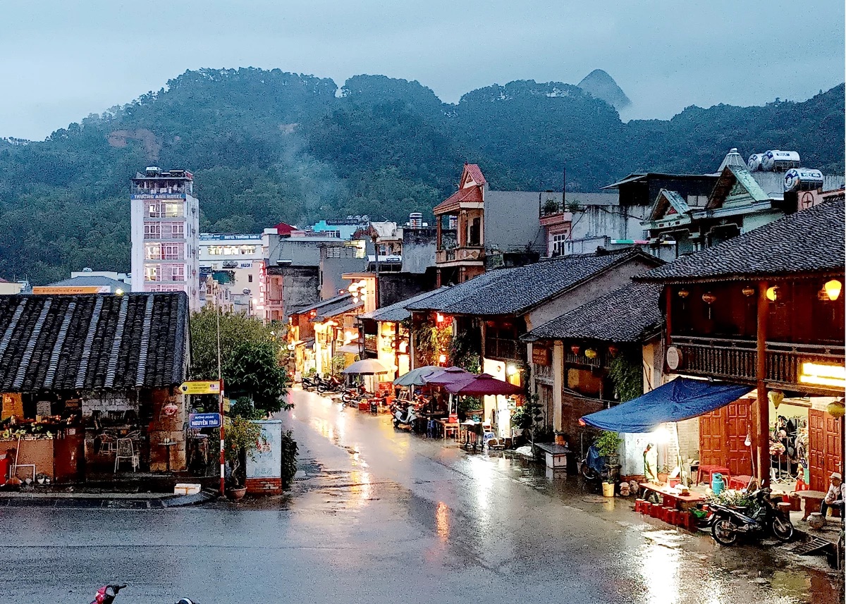
As many Ha Giang Loop itineraries include an overnight stay in Dong Van, there is often time to explore the old quarter in the evening or visit the Sunday market when the travel schedule allows. Beyond its historical attractions, the town offers a closer look at the everyday rhythms of life in the northern highlands.
Hiking and Mountain Routes in Ha Giang
Exploring the Ha Giang Mountains on foot allows travelers to venture beyond the main roads and discover a quieter side of the northern highlands. Hiking routes pass through terraced rice fields, forested hillsides and remote ethnic villages, where the landscape and daily life are closely connected. Depending on the terrain and duration, these journeys can range from short village walks to challenging mountain treks.
Several areas are worth considering for a hiking adventure:
- Dong Van Karst Plateau offers walks through rocky hillsides, traditional villages and small agricultural settlements. The uneven limestone terrain requires careful footing, even on shorter routes.
- Tay Con Linh Mountain, reaching approximately 2,428 meters, is known for its forested slopes and challenging trekking conditions. Longer routes generally require experienced local guidance.
- Hoang Su Phi is particularly appealing for its terraced rice fields and trekking routes through traditional highland villages, with striking scenery during the rice-growing and harvest seasons.
- Villages around the former Ha Giang City provide more accessible walking routes through rural settlements, rice fields and nearby hillsides. These areas are suitable for travelers interested in combining light trekking with local cultural experiences.
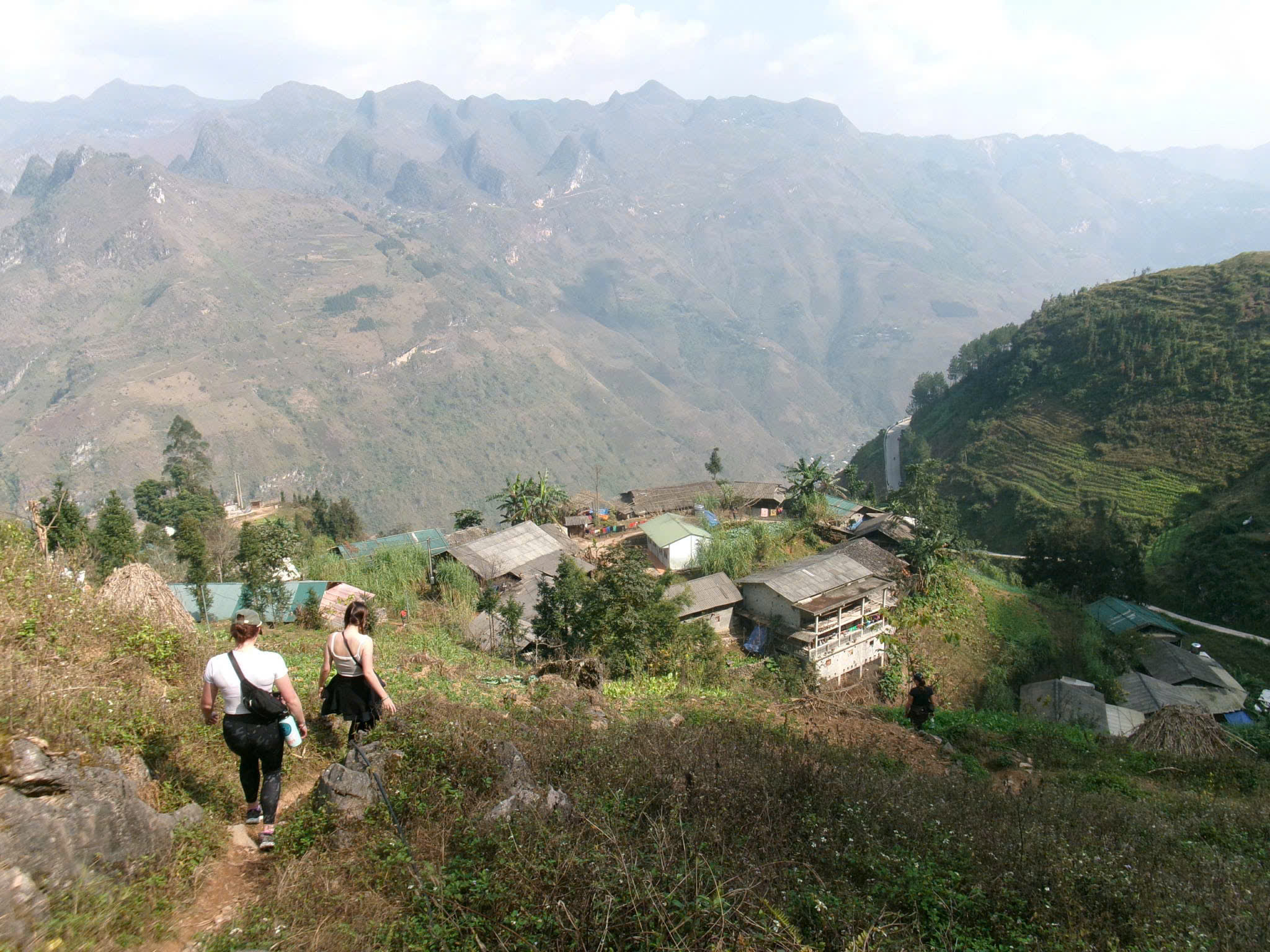
For those who prefer a guided introduction to mountain trekking, our 1-Day Ha Giang Trek: Nature, Waterfalls & Local Culture follows a 16-kilometer route through Thon Tha, Khuoi My and Ha Thanh. Along the way, participants walk through rice terraces, visit Tay and Dao communities and explore the scenery around Ha Thanh Waterfall. The journey offers a closer look at rural life while experiencing Ha Giang’s mountain environment at a slower pace.
Exploring the Mountains Along the Ha Giang Loop
Traveling through the Ha Giang Mountains along the Ha Giang Loop is an adventure shaped by the terrain itself. The route involves continuous climbs, winding descents and narrow mountain roads, where riding conditions can change considerably within a short distance. As a result, the journey requires careful planning, particularly when deciding how many days to spend on the road and whether to ride independently or travel with a local driver.
Most travelers choose a 3-day or 4-day itinerary, depending on their available time and preferred pace. A shorter trip covers the main sections of the route, while an additional day allows for more relaxed travel, longer stops and opportunities to explore places away from the main road. There are also two common ways to experience the journey:
- Self-riding offers greater independence but requires appropriate riding skills, a valid motorcycle license and confidence navigating steep, winding roads.
- Easy Rider tours allow travelers to ride as passengers with experienced local drivers, making it easier to enjoy the journey without managing the demanding road conditions themselves.
At Ha Giang Expeditions, we offer guided motorbike journeys designed around different travel preferences and schedules. With local riders familiar with the mountain roads, our tours provide a practical way to experience the highlands while making time for cultural encounters and scenic stops.
Plan Your Ha Giang Mountain Adventure with Ha Giang Expeditions
The Ha Giang Mountains reveal a fascinating side of northern Vietnam, where extraordinary landscapes and centuries-old cultural traditions make every journey worth experiencing. Whether you’re drawn to scenic mountain roads, outdoor adventures or meaningful encounters with local communities, the right itinerary can help you discover the region at your own pace.
Ha Giang Expeditions offers a diverse selection of journeys, including Classic and Adventure Ha Giang Loops, car and Jeep tours, trekking experiences and combined Ha Giang – Cao Bang itineraries. Led by a local team with deep roots in the region, our tours also offer flexible options tailored to different interests and travel styles. Explore our Ha Giang tours and let us help you plan an unforgettable mountain adventure!