Weather can make a noticeable difference to your experience in Ha Giang, especially when your journey takes you through winding mountain roads and remote highland areas. Conditions that seem pleasant at the start of the day may change as you travel farther into the mountains, making it useful to know what to expect during your visit.
To help you prepare, Ha Giang Expeditions explores monthly temperatures, rainfall patterns, and regional differences in Ha Giang weather, offering practical insights for your upcoming journey.
Table of contents
What Is the Weather Like in Ha Giang?
Ha Giang experiences a subtropical highland climate, shaped largely by its rugged mountains and varying elevations. Weather conditions change throughout the year, following a seasonal pattern in which most rainfall occurs between May and September, while the remaining months are generally drier. Temperatures also fluctuate with the seasons, with warmer conditions during summer and colder weather becoming more noticeable toward the end of the year.
Local weather is also influenced by cloud cover, humidity, and wind, which can change noticeably throughout the day. Moist air may produce low clouds or fog in the mountains, while strong sunshine can raise daytime temperatures even during cooler periods. These conditions contribute to the region’s variable weather, particularly during seasonal transitions.

Ha Giang Weather by Month: Temperature & Rainfall Overview
The difference between Ha Giang’s colder, drier months and its warmer, wetter periods becomes clearer when looking at typical temperatures and rainfall throughout the year. Each part of the calendar brings its own weather patterns, with some changes occurring gradually and others becoming noticeable within a few weeks.
January – March: Cold Temperatures and Early Spring Changes
Winter doesn’t disappear from Ha Giang as soon as the new year begins. Throughout January and February, the cold lingers in the mountains, often accompanied by misty mornings and occasional light drizzle. In Ha Giang City, average daytime highs hover around 20 – 22°C, with nighttime lows of 13 – 14°C. Yet the chill can feel much sharper in Dong Van and Meo Vac, where strong cold spells sometimes bring temperatures close to freezing.
By March, the first signs of warmer weather become more apparent. Daytime highs rise to approximately 24°C, and the damp winter atmosphere gradually gives way to milder conditions. Rainfall also begins to increase, though heavy downpours remain relatively uncommon. The change is gradual, and cooler conditions may still return during occasional late-season cold spells.
April – June: Rising Temperatures and Increasing Rainfall
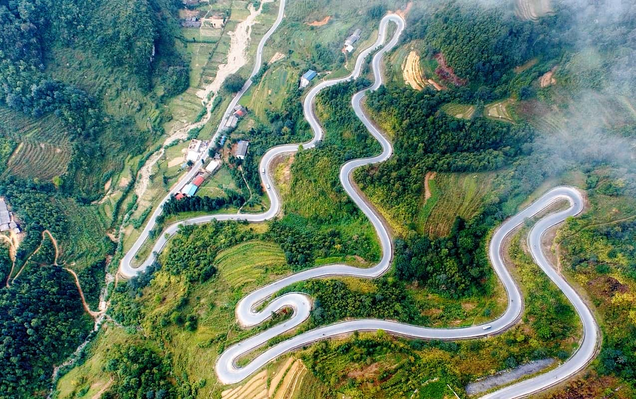
The arrival of warmer weather in Ha Giang brings a noticeable increase in both temperature and rainfall. During these three months, the changes become particularly clear:
- April: Average daytime highs reach around 28°C, with nighttime lows of approximately 19°C. Sunny conditions are still common, although occasional afternoon showers signal the approaching rainy season.
- May: The heat intensifies, with average daytime highs climbing to 32°C and nighttime lows around 24°C. Rainfall becomes more frequent, and rising humidity can make the air feel warmer than the actual temperature.
- June: Temperatures remain high, averaging around 33°C during the day and 26°C at night. Heavy showers and thunderstorms become more common, sometimes bringing substantial rainfall within a short period.
July – September: High Rainfall and Humid Conditions
Rainfall reaches some of its highest levels in Ha Giang during July and August, when frequent downpours and thunderstorms can continue for several hours. Temperatures remain consistently warm across both months, with average daytime highs around 33°C and nighttime lows near 26°C. The combination of heavy rain and persistent humidity often leaves the air feeling damp and uncomfortable, even during breaks in the rain.
By September, the intensity of the rainy season gradually begins to ease. Average daytime highs fall to approximately 31°C, with nighttime lows around 24°C, bringing slightly cooler conditions. Although rainfall becomes less frequent, occasional heavy showers remain possible, particularly during the early part of September. The transition toward drier conditions can vary from year to year, depending on the strength and duration of the summer monsoon.

October – December: Cooler Weather and Lower Rainfall
Lower rainfall and gradually cooler temperatures characterize the final three months of the year in Ha Giang. October still retains some warmth, with average daytime highs around 29°C and nighttime lows near 21°C. By November, temperatures settle into a cooler range of 18 – 25°C, making the difference between sunny afternoons and chilly evenings more noticeable.
Ha Giang weather in December brings a sharper winter chill, particularly after sunset. While average temperatures in Ha Giang City range between 14°C and 22°C, higher areas such as Dong Van and Meo Vac can experience temperatures below 5°C during strong cold spells. Rainfall remains relatively low, although cold winds, mist, and low clouds can persist in the highlands, especially during the early morning hours.
How Does Weather Differ Across Ha Giang?
A single weather forecast rarely tells the full story of conditions along the Ha Giang Loop. The climate around Ha Giang City, the northern limestone plateau, and the mountain valleys can differ considerably, giving each destination its own weather characteristics.
Ha Giang City
Ha Giang City sits in a river valley surrounded by mountains, where the relatively sheltered terrain allows warmer conditions than those found on the higher sections of the Loop. Summer daytime temperatures commonly reach 30 – 33°C, with humidity adding to the heat, particularly during periods of heavy rainfall. Winter is considerably milder, with average daytime highs around 20 – 22°C in December and January, although evenings and early mornings can still feel chilly.
The city’s valley setting also means that the weather forecast here may give a warmer impression of conditions than travelers will experience farther north.
Dong Van and Meo Vac
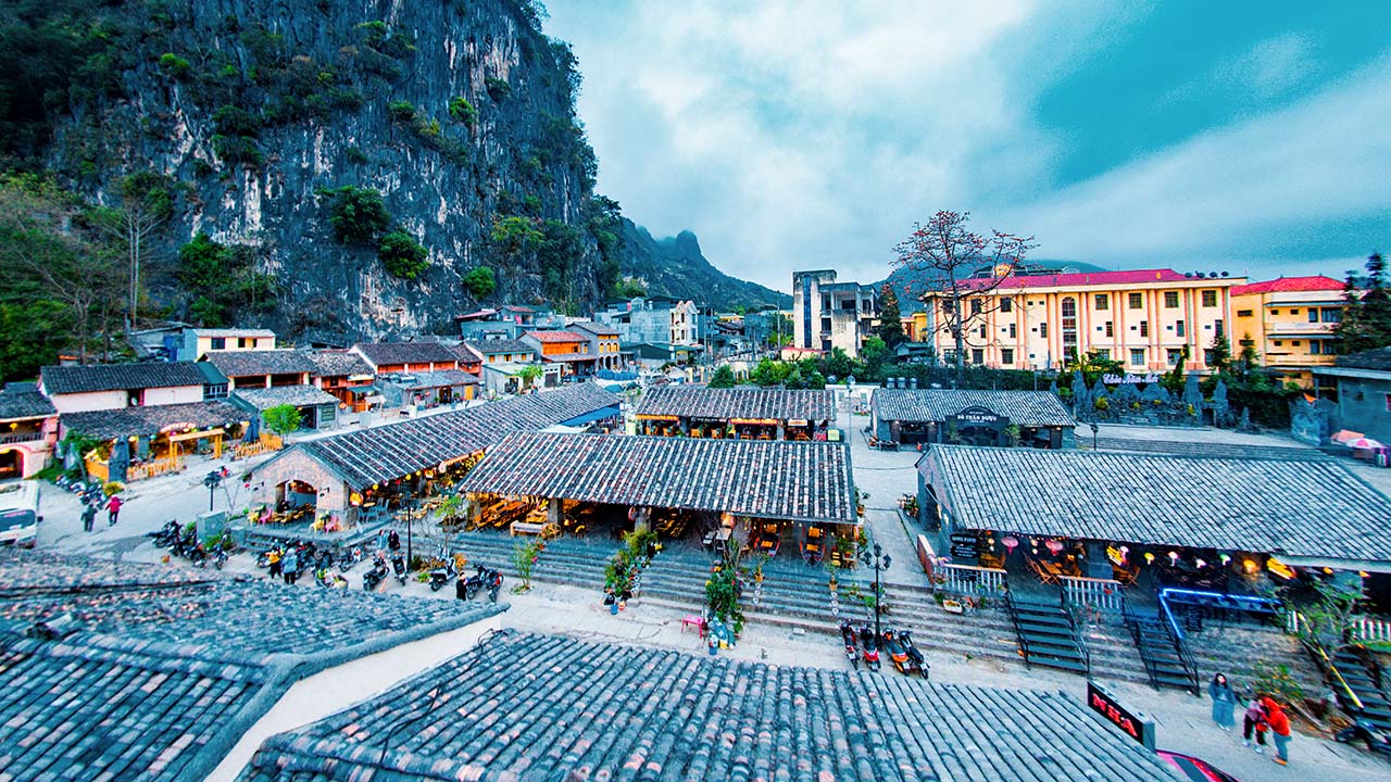
At higher elevations, the cooler climate of Dong Van and Meo Vac becomes apparent even during the summer months. Around Dong Van, average daytime highs are approximately 25°C during June, July, and August, offering a noticeably different temperature range from Ha Giang City. Winter brings much colder conditions, with January and February daytime highs often averaging around 13 – 15°C.
The limestone plateau also experiences considerable temperature changes between sunny afternoons and cold nights. During strong winter cold spells, temperatures in exposed highland areas can approach freezing. Meo Vac’s valleys and surrounding slopes add further local variation, meaning temperatures may differ between the town center and nearby mountain roads. These differences are particularly noticeable during early morning and evening hours.
Du Gia
Du Gia’s valley setting gives it a different atmosphere from the rocky highlands of Dong Van. Surrounded by green hills and mountains, the village lies at a lower elevation, where daytime temperatures are generally warmer. During the rainy season, frequent showers and moisture from the surrounding landscape can create humid conditions, particularly in sheltered parts of the valley.
The hills around Du Gia influence how clouds and rainfall move through the area, sometimes producing localized showers that do not affect other sections of the Ha Giang Loop. Mist may also settle over the valley during cool, humid mornings, gradually clearing as temperatures rise. This combination of warmer valley air, moisture, and surrounding hills creates weather conditions that can differ noticeably from those experienced on the northern limestone plateau.

Ma Pi Leng Pass
Visibility can be the biggest weather concern at Ma Pi Leng Pass. Rising to approximately 1,500 meters above sea level, the pass runs along steep limestone mountains where low clouds and fog can quickly obscure the surrounding landscape. On misty days, the famous views over the Nho Que River may disappear behind thick cloud cover, even when nearby towns have relatively clear skies.
Its exposed position also makes the pass particularly windy. Strong gusts can intensify the feeling of cold, especially during winter, while rain and low clouds may reduce visibility along the winding road. Weather conditions can vary considerably across different sections of the pass, making the mountain crossing more sensitive to local changes in wind, cloud cover, and moisture.
How to Check the Weather Before Your Ha Giang Trip
Mountain weather can be difficult to predict several days in advance, so checking the forecast at the right time is particularly important when planning a Ha Giang Loop trip. A 7-day forecast can give you an early idea of expected conditions, but predictions generally become more reliable within 24 – 72 hours of your departure. When preparing for your Ha Giang Loop trip, pay attention to these details:
- Check forecasts for multiple locations: Weather in Ha Giang City may differ significantly from Dong Van, Meo Vac, and Du Gia. Look up the forecast for each destination on your planned route.
- Look beyond the chance of rain: A 60% chance of rain indicates the probability of precipitation, not its intensity. Check the expected rainfall in millimeters (mm), the timing of showers, and thunderstorm warnings.
- Compare daytime highs and nighttime lows: Temperatures can drop considerably after sunset, especially in the highlands. Wind speed and gust forecasts are particularly useful for exposed mountain passes.
- Pay attention to official weather warnings: Heavy rainfall can trigger flash floods and landslides in mountainous areas. Follow local weather alerts and road condition updates when rain is forecast.

Plan Your Ha Giang Trip with Ha Giang Expeditions
Mountain weather can be unpredictable, but a little preparation can make your Ha Giang adventure much more enjoyable. At Ha Giang Expeditions, our local team can help you stay informed about weather conditions along the route, answer questions about what to expect during your travel dates, and provide practical advice for your upcoming journey.
Ready to explore Ha Giang? Get in touch with us to discuss your travel plans, check available tours, and book your adventure.
Contact us:
- Ms. Hana: (+84) 8686 433 38
- Ms. Phuong: (+84) 39 767 98 89
- Email: info@hagiangexpeditions.com
Frequently Asked Questions
Can you visit Ha Giang during the rainy season?
Yes, you can visit Ha Giang during the rainy season, which typically lasts from May to September. However, frequent showers and occasional heavy rainfall can affect mountain roads and outdoor activities. Keeping your travel plans flexible and checking local weather warnings is particularly important during this period.
What should I wear for the Ha Giang Loop in winter?
Winter temperatures can drop significantly in Ha Giang’s highlands, especially around Dong Van and Meo Vac. Wear warm layers, including a thermal base layer, a fleece or sweater, and a windproof jacket. Gloves, a scarf, and warm socks are also useful for early morning rides and exposed mountain passes.
Does it snow in Ha Giang?
Snow is rare in Ha Giang, although exceptionally strong cold spells can occasionally bring snowfall to the highest mountain areas. Frost and ice are more common when temperatures fall close to freezing. If you’re hoping to see snow during your visit, keep in mind that it is an unusual weather event and cannot be reliably predicted far in advance.