A quick look at the Ha Giang Loop map reveals a network of mountain roads, where the main circuit branches off toward hidden villages, remote viewpoints, and quieter valleys. Some stretches follow dramatic ridgelines, others descend into deep valleys before climbing back into the highlands. With so many turns and possible detours, the route you follow can shape the entire journey. The Ha Giang Loop route offers plenty to explore, and Ha Giang Expeditions will help you trace its winding paths, discover lesser-known stretches, and see how the different roads connect across the mountains.
Table of contents
Ha Giang Loop Route Map: The Full Circuit
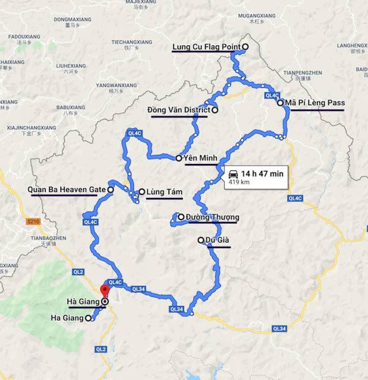
The Ha Giang Loop follows a circular route that begins and ends in Ha Giang, with National Highway 4C forming the main northern section. From the starting point, the road passes through Quan Ba and Yen Minh before reaching Dong Van and Meo Vac. These destinations serve as important reference points on the map, helping travelers follow the circuit and identify the roads connecting each section.
After Meo Vac, the route turns south through a network of provincial and local roads. The return journey can pass through Mau Due and continue toward areas such as Du Gia or Nam Dam before reaching Ha Giang again. The exact route depends on the connections chosen, making it useful to identify the main junctions before setting off.
Following the Ha Giang Loop Road by Road
Following the Ha Giang Loop from start to finish reveals how the route changes across different parts of the highlands. The northern section follows Highway 4C through mountain towns and limestone terrain, before the road crosses Ma Pi Leng Pass and turns south toward the return circuit. Along the way, several landmarks and junctions help define each stretch of the journey.
Ha Giang to Quan Ba: Entering the Mountains
The first stretch of the Ha Giang Loop gradually takes you away from the bustling streets of Ha Giang and into the mountains along National Highway 4C. The road begins to climb through forested hills, passing small villages and terraced fields before opening up to sweeping views of the valleys below.
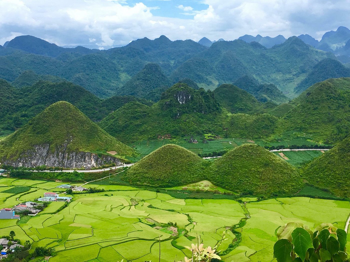
Around 40 kilometres from Ha Giang, Quan Ba Heaven Gate marks one of the first major viewpoints along the route. From here, the famous Twin Mountains rise above Tam Son Valley, surrounded by green fields and scattered houses. The view offers a glimpse of the dramatic landscapes waiting farther north.
From Heaven Gate, the road descends toward Tam Son, the main town in Quan Ba. This is a useful point to check your route before continuing along Highway 4C toward Can Ty and Yen Minh, where several smaller roads branch toward local villages.
Quan Ba to Yen Minh: Winding Through the Valleys
The road between Quan Ba and Yen Minh offers more than a straightforward connection between two towns. As Highway 4C winds through the mountains, several places along the way invite you to slow down and explore the surrounding landscape.
A few locations worth marking on your route include:
- Lung Tam Linen Village: A detour from the main road leads to this H’Mong village, known for its traditional hemp weaving and handmade textiles.
- Can Ty: The winding roads around this area reveal striking mountain scenery, with limestone formations rising above narrow valleys.
- Yen Minh Pine Forest: Near Yen Minh, pine-covered hills create a noticeably different landscape from the rocky mountains farther north.
Yen Minh to Dong Van: Across the Rocky Plateau
Beyond Yen Minh, the landscape becomes increasingly rugged as the road enters the Dong Van Karst Plateau. Limestone peaks dominate the horizon, and small fields appear between rocky slopes where local communities have adapted to the challenging terrain.
One of the most photographed sections is Tham Ma Slope, where a series of tight hairpin bends climbs the mountainside. Continuing along Highway 4C, the road passes through Sa Phin, home to the historic H’Mong King’s Palace.
Route note: Around Sa Phin, travelers will encounter junctions leading toward other parts of the Dong Van Karst Plateau. Check the road signs carefully before continuing to Dong Van, especially if you plan to explore locations away from Highway 4C.
Dong Van to Meo Vac: Crossing Ma Pi Leng Pass
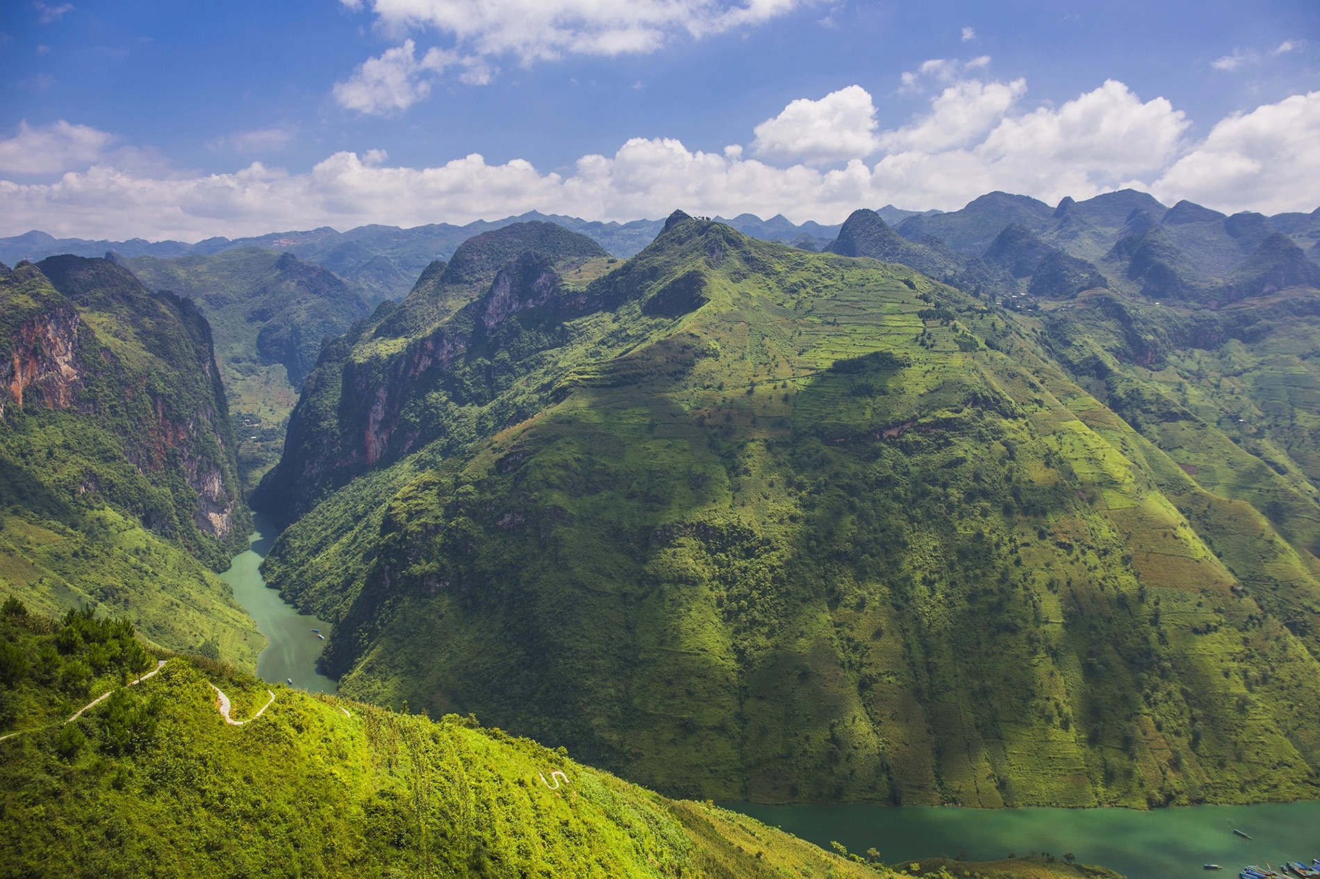
The road from Dong Van to Meo Vac is where the Ha Giang Loop reaches some of its most dramatic heights. Running along Happiness Road, the approximately 20-kilometre Ma Pi Leng Pass cuts across steep mountainsides, with towering cliffs on one side and the deep Nho Que River valley on the other.
The landscape changes with every bend. At certain points, the road opens toward the turquoise Nho Que River winding through Tu San Canyon, creating one of the most recognizable views of the entire loop.
A few things worth knowing along this stretch:
- Viewpoints: Several stopping areas offer panoramic views of Ma Pi Leng Pass and the Nho Que River valley.
- Nho Que boat trip: The boat landing is reached via a separate access road, so it is not directly on the main pass.
- Road conditions: Sharp curves, steep drops, and changing visibility make this a section where extra attention is needed.
Meo Vac to Ha Giang: Completing the Loop
The final section of the Ha Giang Loop is not necessarily a repeat of the roads you have already traveled. From Meo Vac, the route can turn south toward Mau Due, opening up a network of mountain roads that eventually reconnect with Ha Giang.
Unlike the exposed limestone scenery around Dong Van, parts of the southern route pass through greener valleys, terraced hillsides, and villages surrounded by farmland. The scenery feels noticeably different, giving the return journey its own character.
Key connections on the southern return route:
- Mau Due: An important point along the road south of Meo Vac, connecting travelers with routes through the surrounding mountain valleys.
- M Road: Recognizable for its series of M-shaped curves, this stretch is one of the scenic highlights on the return journey.
- Lao Va Chai Viewpoint: A stop featured in Ha Giang Expeditions’ routes, offering wide views of the surrounding highlands.
From this section, the journey continues through connecting roads toward Ha Giang. The exact return route varies, with some itineraries including overnight stops in villages such as Nam Dam or Du Gia.
Scenic Detours Beyond the Main Ha Giang Loop
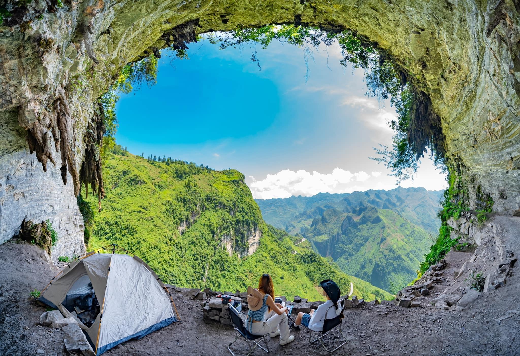
The main Ha Giang Loop follows a recognizable circuit, but several roads branching away from it reveal landscapes and communities that deserve a closer look. These alternative stretches bring a different rhythm to the journey, from the northernmost villages near the Chinese border to the green valleys of Du Gia. Their locations and connections to the main route are worth considering when tracing your journey on the map.
The Northern Detour to Lung Cu
Near the northern end of the Dong Van Karst Plateau, a road branches away from the main route toward Lung Cu, close to the Vietnam–China border. The landscape here is dominated by limestone peaks, narrow mountain roads, and small settlements scattered across the rocky terrain.
The most recognizable landmark is Lung Cu Flag Tower, standing on Dragon Mountain and offering sweeping views of the surrounding highlands. Nearby, Lo Lo Chai Village provides a closer look at the traditional earthen houses and cultural heritage of the Lo Lo ethnic community.
- Tip: Lung Cu is not directly on the main Ha Giang Loop circuit. Travelers can take the northern detour from the Dong Van area and reconnect with the main road to continue toward Ma Pi Leng Pass. The additional distance should be considered when planning the route.

The Road Through Du Gia
Du Gia offers a quieter side of the Ha Giang highlands, where the road passes through cultivated valleys, forested hills and villages surrounded by farmland. The landscape feels more rural than the exposed limestone terrain around Dong Van, with traditional houses and rice fields becoming a familiar sight along the way.
The village is also a place to experience local life beyond the main sightseeing stops. Travelers can explore the surrounding countryside, visit Du Gia Waterfall or spend time in a local homestay, where the pace of life is closely connected to the mountains and farmland.
- Worth noting: Du Gia is not included in every Ha Giang Loop route. Some journeys follow the southern roads through this area, giving travelers an opportunity to explore a quieter part of the region before returning to Ha Giang.
How to Follow the Ha Giang Loop on Google Maps
Google Maps allows you to build the Ha Giang Loop route by adding destinations in the order you plan to visit them. This is particularly useful for a circular journey, where the shortest route between two points may not follow the mountain roads you want to explore. Setting up the full circuit in advance also makes it easier to locate key stops and check individual sections along the way.
Here’s how to set up your Ha Giang Loop route on Google Maps:
- Set your starting point: Search for Ha Giang and select your departure location.
- Add the main stops: Enter Quan Ba, Yen Minh, Dong Van, and Meo Vac in the order you plan to visit them.
- Include scenic detours: Add Lung Cu, Lo Lo Chai, or Du Gia as separate stops if they are part of your route.
- Check the return journey: Add intermediate locations such as Mau Due before setting Ha Giang as your final destination.
- Save an offline map: Download the relevant area in Google Maps before leaving, as mobile coverage can be unreliable in remote mountain regions.
Navigation tip: Google Maps can help you follow the route, but its estimated travel times may not fully account for steep mountain roads, frequent stops, or changing conditions. Offline maps are useful when mobile coverage is limited, although motorcycle-specific directions are unavailable offline. Keep your planned stops accessible and check with our local guides if you are unsure about a particular road.
Reading the Ha Giang Loop Map Before You Go
Distances on the Ha Giang Loop can be deceiving. A short stretch on the map may involve steep climbs, tight hairpin bends, or narrow roads that take considerably longer to navigate than expected. Looking beyond the distance between destinations can give you a more realistic picture of the journey.
When reviewing your Ha Giang Loop map, pay attention to a few details that may affect your route:
- Main roads and smaller branches: National Highway 4C connects many of the major destinations, but smaller roads may lead to remote villages or alternative routes. Check where these branches reconnect before including them in your journey.
- Elevation and terrain: Roads crossing mountain passes can involve significant changes in elevation. Use the terrain layer on Google Maps to get a better sense of the surrounding landscape, although it does not show every steep section of the road.
- Travel distances: A 30-kilometre mountain stretch can take much longer than the same distance on a flat road. Allow time for winding sections, viewpoints and stops along the way.
- Road accessibility: Rainfall, landslides or maintenance work may affect certain sections, particularly smaller mountain roads. Check recent local information before relying on a particular connection.
A useful reminder: A map shows where the roads lead, but it cannot always reflect their current condition. Ha Giang Expeditions’ local guides can provide practical insights into mountain routes and help identify suitable alternatives when conditions change.

Discover the Roads of Ha Giang with Local Experts
Every turn on the Ha Giang Loop has a story, from mountain roads carved into steep cliffs to hidden paths leading toward remote villages. With local knowledge built through years of exploring these highlands, Ha Giang Expeditions brings you closer to the landscapes, communities, and lesser-known routes that make the journey memorable.
Our experienced local guides know the roads, the places worth stopping, and the connections that are easy to miss on a map. Let Ha Giang Expeditions accompany you on your journey through the northern highlands, discovering breathtaking landscapes, hidden mountain roads, and authentic local experiences along the way.
Contact us:
- Ms. Phuong: (+84) 39 767 98 89
- info@hagiangexpeditions.com