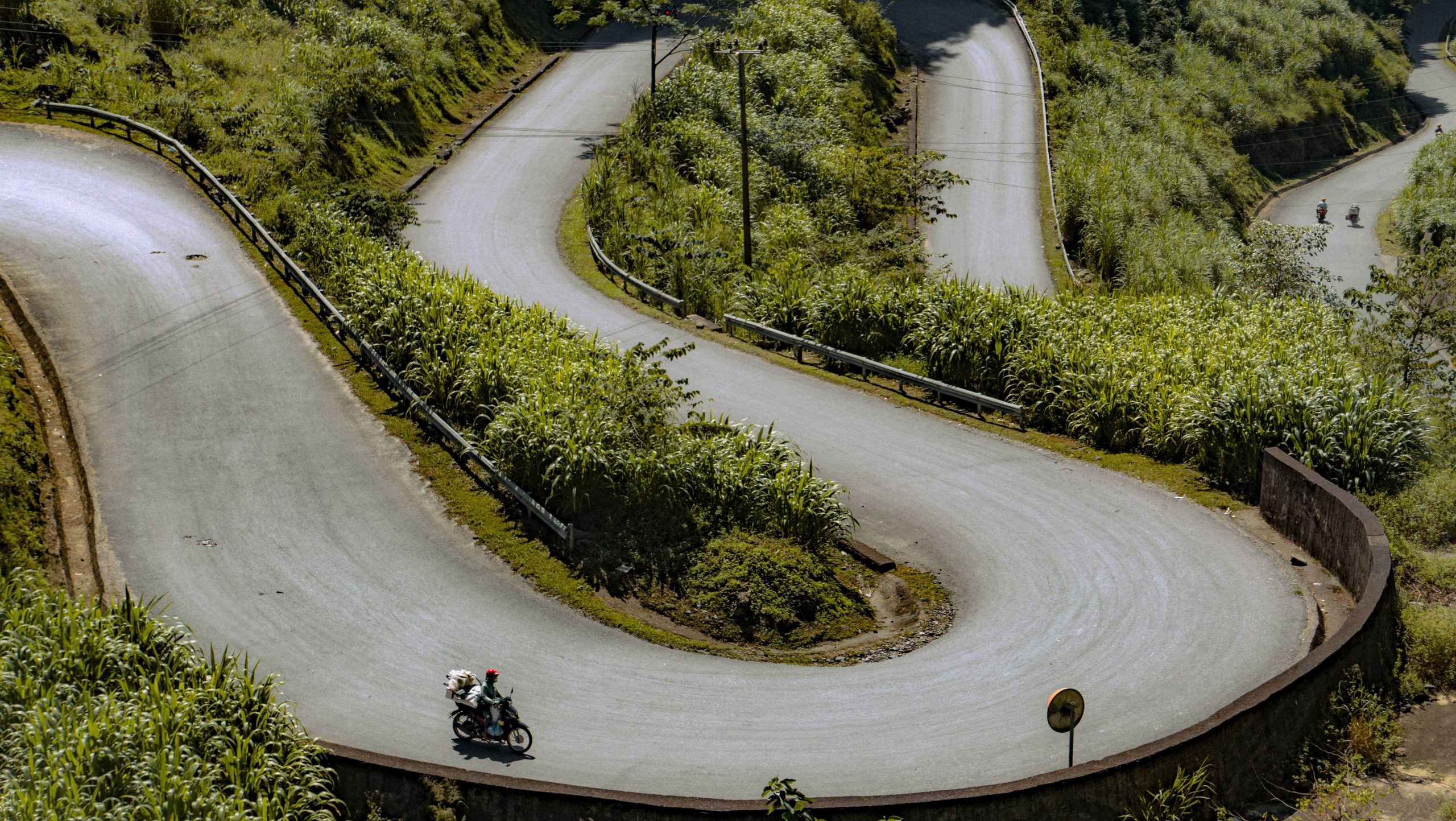
Tham Ma Slope – A Challenging and Scenic Pass in Ha Giang
Tham Ma Slope is one of the most iconic and thrilling mountain passes on the Ha Giang Loop. Located on Highway 4C, it winds its way through the dramatic landscape between Ha Giang City and Dong Van district. Although only 5 kilometers long, this steep and zigzagging road captivates travelers with its breathtaking beauty and adventurous curves.
From above, Tham Ma resembles a smooth S-shaped ribbon nestled between green mountain walls. It’s no surprise this spot has become a favorite photo stop and a must-see highlight for adventure seekers exploring northern Vietnam.
🌍 Where Is Tham Ma Slope?
Tham Ma Slope lies in Yen Minh District, about 10 kilometers before reaching Dong Van. It connects Lung Thau and Van Chai villages, resting at an altitude of around 1,500 meters. Despite its short length, the road is steep, narrow, and full of hairpin turns—making it both thrilling and unforgettable.
🏞️ A Road with Views Worth the Challenge
Riders and drivers must navigate sharp curves along steep cliffs. However, the reward is unmatched: sweeping views of limestone peaks, valleys, and terraces. From the top, you can see the signature S-shaped curve of Tham Ma Pass—perfect for drone shots and memorable photos. Ethnic minority children, often carrying flowers or snacks, add an authentic cultural touch to the scene.
🧭 Historical and Cultural Significance
Tham Ma Slope isn’t just a stunning landscape—it also has a unique place in local Hmong history. In the past, this road was used to test the strength of horses. Locals would load horses with heavy goods and make them climb the slope. If the horse reached the top in good condition, it was kept. If not, it was used to make Thắng Cố, a traditional highland stew found in ethnic markets.
Today, while few still follow this tradition, the legend adds rich cultural depth to the pass.
👣 Local Life Around the Slope
As you pass through Tham Ma, you’ll notice Hmong communities cultivating corn and beans on the rocky slopes. They use stones to build homes and raise livestock suited to the highland climate. The landscape might look harsh, but it’s home to a vibrant, resilient culture that continues to thrive.
📸 Photography Tips for Tham Ma Slope
-
Best time to shoot: Early morning (7–9 AM) or golden hour (4–5 PM)
-
Drone recommended: To capture the full winding shape of the road
-
Dress warmly: The altitude can bring sudden chills
-
Respect locals: Ask before photographing people, especially children
🧭 Nearby Attractions to Explore
While Tham Ma is a major stop, the region offers more:
-
Ma Pi Leng Pass – one of the “Four Great Passes” of Vietnam
-
Lung Tam Weaving Village – famous for Hmong textile art
-
Dong Van Old Quarter – historic town with colonial influences
-
King’s Palace (Dinh Vua Meo) – residence of Hmong royalty
These stops are often included in the Ha Giang Loop tours operated by Ha Giang Expeditions.
✅ Why Visit Tham Ma Slope?
If you’re searching for an unforgettable view, a rush of adrenaline, and a deeper connection with local culture, Tham Ma Slope is a must. Whether you’re on a motorbike, in a car, or hiking along the route, this short but powerful stretch of road will leave a lasting impression.
🚐 Join a Tour with Ha Giang Expeditions
Want to experience Tham Ma Slope and other epic stops on the Ha Giang Loop?
Our motorbike and car tours include top scenic passes, cultural villages, and local guides who share real insights into Hmong life and legends.


